


Global coverage
Realistic windfields
Delivered to your inbox
Built by CAT modellers
How it works
1
Sign up
Enter your details and select the regions where you have exposure.
2
Get alerts
Receive email alerts when a CAT 1+ storm is expected to track within 750km of land in your selected regions, with 1km windfield data showing where damage is most likely.

Go deeper
These alerts show you where the risk is. Reask's LiveCyc tells you what to do about it. When you need site-specific exceedance probabilities and a pre-agreed decision framework before the season starts, that's the next conversation.
Get started
Free. No commitment. Takes 60 seconds.
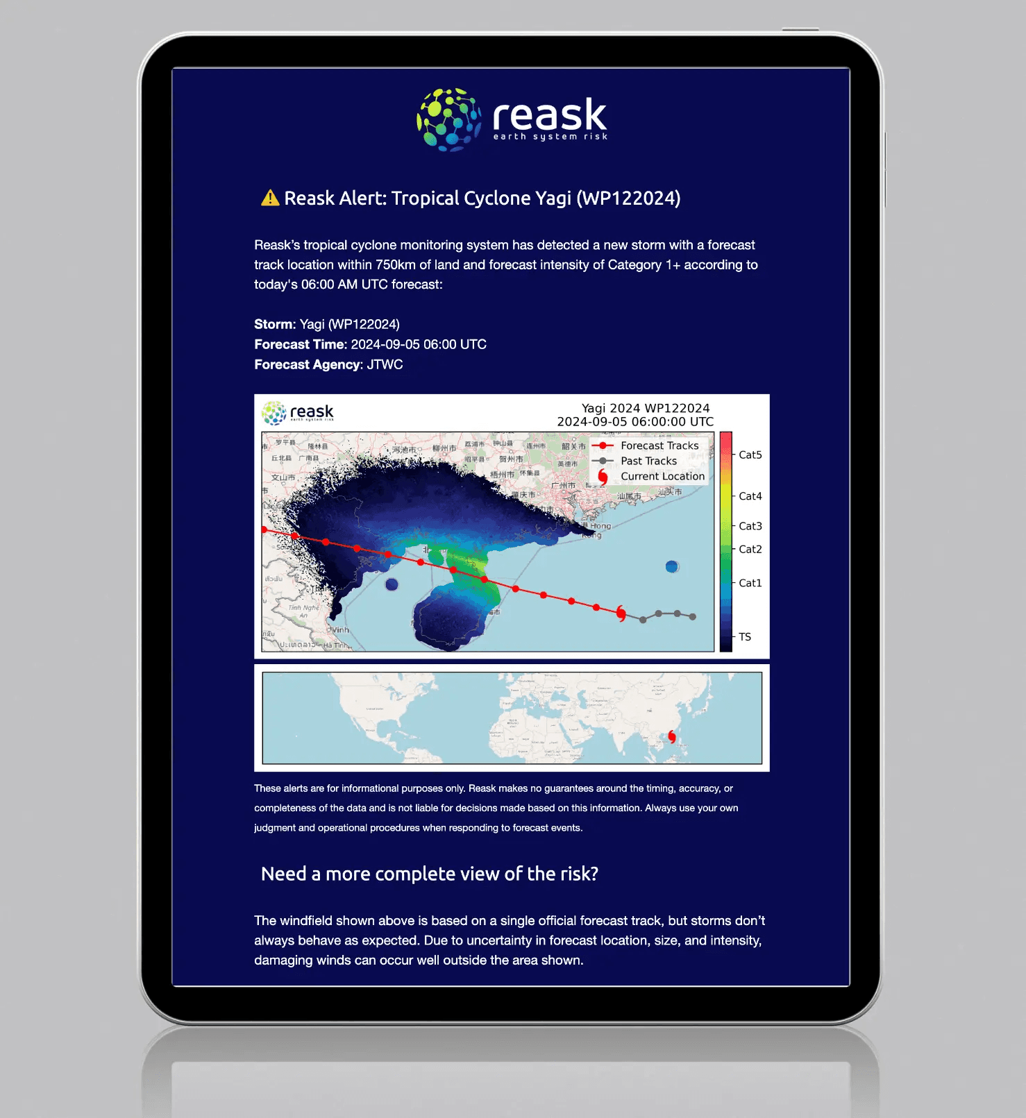
Each alert includes the storm name and identifier, the issuing forecast agency and timestamp, the expected landfall region, the official track, and a Reask-modelled windspeed snapshot at 1km resolution.
Alerts are sent when a CAT 1+ storm is expected to track within 750km of land in your selected regions. During an active storm, updates follow as the track evolves.


FAQs
Find answers to common questions about Reask’s tropical cyclone forecast alert system, including how it works, what’s in each forecast, and who it’s designed for.
Can I access more detailed tropical cyclone forecast data?
What's included in a Reask tropical cyclone alert email?
How does Reask's tropical cyclone warning system work?
Who are Reask's tropical cyclone alerts built for?
How often will I receive tropical cyclone alerts?
Still have questions?
Our team of catastrophe modellers is here to help. If you're looking for site-specific probabilities or operational decision support during hurricane season, ask us about LiveCyc.
